Descrizione
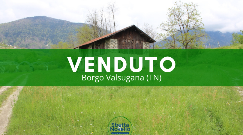
Agenzia immobiliare Sbetta e Novello propone in vendita un edificio rustico da ristrutturare.
Situato in posizione decisamente interessante, immerso nel verde e circondato da aree agricole.
Nelle vicinanze centro commerciale Le Valli di Borgo Valsugana, in posizione tranquilla e soleggiata.
Rustico di ampie dimensioni da ristrutturare circondato da 1.300 mq di terreno ideale per chi vuole stare in campagna avendo però tutti i servizi a portata di mano.
Struttura storica a sasso con copertura in legno.
Possibilità di cambio di destinazione d’uso ad abitativo per la realizzazione di una casa singola o più unità abitative.
All’edificio possono essere abbinati due appezzamenti di terreno per circa totali 7.000 mq. (prezzo extra di 10 €/mq).
Terreni già serviti da impianto irriguo, strada rustica di accesso e attualmente adibiti a prato stabile.
Adatto per chi volesse intraprendere una attività agricola o agrituristica.
Indirizzo
Indirizzo:
Castelnuovo TN Località Ceggio
-
Stato:
Italia
-
Provincia:
Trento
-
Città:
Borgo Valsugana
-
CAP:
38050
Aprire in Google Maps
-
ID Proprietà
2604
-
Prezzo
€150.000
-
Categoria Proprietà
Da ristrutturare, Indipendente, Rustico, Terreno, Terreno agricolo
-
Status Proprietà
Vendita
-
Stanze
1
-
Camere da letto
1
-
Anno di Costruzione
1930
-
Superficie
315 m2
-
Prefisso
1300 m2
-
Prestazione energetica
esente APE
-
piano terra
135 mq
-
piano primo
135 mq
-
tettoria
30 mq
-
legnaia
15 mq
-
terreno
1.300 mq
Calcola Indicazioni Stradali
");
var marker = new google.maps.Marker({
map: map,
position: place.geometry.location,
icon: place_icon
});
google.maps.event.addListener(marker, 'click', function () {
infowindow.setContent('
'+place_label+'' +''+place.name);
infowindow.open(map, this);
});
bounds.extend(marker.position);
//now fit the map to the newly inclusive bounds
map.fitBounds(bounds);
var google_map_style = ere_property_map_vars.google_map_style;
if (google_map_style !== '') {
var styles = JSON.parse(google_map_style);
map.setOptions({styles: styles});
}
var boundsListener = google.maps.event.addListener((map), 'bounds_changed', function (event) {
this.setZoom(12);
google.maps.event.removeListener(boundsListener);
});
}
google.maps.event.addDomListener(window, 'load', initialize);
function distance(latitude, longitude) {
var lat1 = lat;
var lng1 = lng;
var lat2 = latitude;
var lng2 = longitude;
var radlat1 = Math.PI * lat1 / 180;
var radlat2 = Math.PI * lat2 / 180;
var theta = lng1 - lng2;
var radtheta = Math.PI * theta / 180;
var dist = Math.sin(radlat1) * Math.sin(radlat2) + Math.cos(radlat1) * Math.cos(radlat2) * Math.cos(radtheta);
dist = Math.acos(dist);
dist = dist * 180 / Math.PI;
dist = dist * 60 * 1.1515;
if (distance_in == "km") {
dist = dist * 1.609344;
} else if (distance_in == "m"){
dist = dist * 1.609344 * 1000;
}
var result=Math.round(dist * 100) / 100;
result=result.toLocaleString().replace(/[^\d.]/ig, ',');
return result;
}
function setScroll() {
var $this = $('#nearby-places-detail');
var map_height = $('#googleMapNearestPlaces');
var height = $this.height();
if (height >= map_height.height()) {
$this.css('position', 'relative');
$this.css('max-height', +map_height.height());
$this.css('overflow-y', 'scroll');
$this.css('overflow-x', 'hidden');
$this.perfectScrollbar({
wheelSpeed: 0.5,
suppressScrollX: true
});
}
}
}
};
$(document).ready(G5PlusGoogleMap.init);
})
(jQuery);